St. Johns Bridge Scenic River Access
Address:
2320 County Rd 6
Tiffin, OH 44883
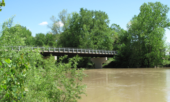
This nearly 1-acre site is located along the strip of land between South Township Road 131 and the west bank of the Sandusky River south of St. John’s Bridge. The bridge, which follows County Road 6 over the Sandusky River, is located about 0.85 miles east the of the road’s intersection with State Route 53.
A drive allowing access to the site is off the east side of Township Road 131 about 370 feet south of its intersection with County Road 6. The access site is adjacent downstream to the former St. John’s Dam which was constructed in the early 1900s and removed in fall 2003. The dam was removed for numerous reasons including improving fish and wildlife habitat, and improving water quality and recreation.
Today this portion of the scenic river has excellent smallmouth bass fishing which is aided by the diverse and abundant macroinvertebrate population found during post-dam removal studies. According to the U.S. EPA’s online information for monitoring and assessing water quality in rivers and streams, in wadable streams (streams that can be easily walked across, with water no deeper than about thigh-high), the three most common biological organisms studied are fish, algae and macroinvertebrates.
Macroinvertebrates are organisms that are large enough to be seen with the naked eye and lack a backbone. Examples of aquatic macroinvertebrates include insects in their larval or nymph form, crayfish, clams, snails and worms.
A small parking lot provides easy access to the river, although the area is undeveloped.
Amenities: Fishing, Wildlife Viewing, Parking, Small Boat Access, Portage Required, Scenic River, Pet Friendly

Get Your Free Copy!
DOWNLOAD THE GUIDE »
Follow us:
Tiffin, Ohio 44883
Friday: 8AM - 3PM